High quality Rtk Gnss Gps – Surveying Instrument Hi-target IRTK5 GNSS RTK System – Haodi

High quality Rtk Gnss Gps – Surveying Instrument Hi-target IRTK5 GNSS RTK System – Haodi Detail:
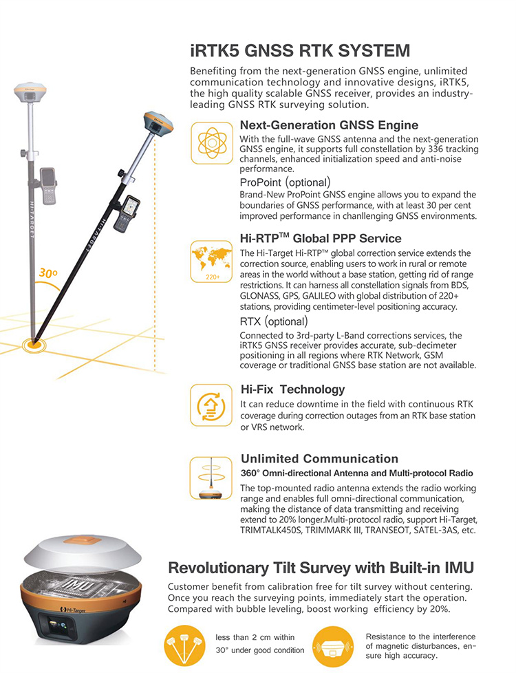
Hi-RTP Global PPP Service
The correction source has been extended by Hi-RTP global correction service provided by Hi-Target. Enabling users to work without a base-station in rural or remote areas anywhere in the world.
HD Touchable OLED Screen
The newly designed HD OLED screen, which has RGB color and is touchable, has 1.3″ and 240*240 resolutions. Users can quickly check and set the receiver status for easier fieldwork.
Revolutionary Tilt Survey with Built-in IMU
Customers benefit from calibration-free for tilt surveys without centering. Once you reach the surveying points, immediately start the operation. Compared with bubble leveling, boost working efficiency by 20%.
Specification
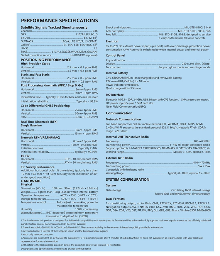
| Configuration | Detailed indicators | |
| GNSS Configuration | Satellite signals tracked simultaneously | Channels:660 |
| BeiDou: B1, B2, B3 | ||
| GPS: L1C/A, L2C, L2E, L5 | ||
| GLONASS: L1C/A, L2C/A, L3 CDMA | ||
| GALILEO: E1, E5A, E5B, E5AltBOC, E6 | ||
| SBAS: L1C/A, L5 | ||
| QZSS, WAAS, MSAS, GAGAN, IRNSS | ||
| Support the PPP service | ||
| Output format | ASCII: NMEA-0183, binary data | |
| Positioning output frequency | Maximum 50Hz | |
| Static data format | GNS and Rinex | |
| Message type | CMR, RTCM2.X, RTCM3.0, RTCM3.2 | |
| Network model | VRS, FKP, MAC; support NTRIP | |
| System Configuration | Operating system | Cortex-A5 core, Linux |
| Data storage | Circulating 16GB internal storage; records GNS and RINEX formats simultaneously | |
| Accuracy and Reliability[1] | RTK | Horizontal: 8mm +1ppm RMS |
| Positioning | Vertical: 15m +1ppm RMS | |
| Static | Horizontal: 2.5mm +0.5ppm RMS | |
| Vertical: 5mm + 0.5ppm RMS | ||
| Initialization time | <10s | |
| Initialization reliability | >99.99% | |
| Connector | External connector | 5-pin socket, USB socket, antenna port and SIM card slot |
| Communication | Cellular mobile | Internal 4G mobile network:TDD-LTE, FDD-LTE, WCDMA, EDGE, GPRS, GSM |
| WiFi | 802.11 b/g access point and client mode, WiFi hotspot available | |
| Blue tooth | Blue tooth 4.0/2.1+EDR, 2.4GHz | |
| Internal UHF transceiver radio | Transmitting power: 0.1W-1W adjustable | |
| Frequency: 403MHz-473MHz | ||
| Protocol: HI-TARGET, TRIMTALK450S, TRIMMARK, TRANSEOT | ||
| Bands: 116 bands(16 bands are configurable) | ||
| Working Range: Typically 3-5 km ,optimal 5-8 km | ||
| External | Transmitting power: 5W/25W adjustable | |
| UHF radio | Working voltage: 9-16V | |
| Frequency: 410MHz-470MHz | ||
| Working Range: Typically 8-10 km ,optimal 15-20 km | ||
| Sensor | Electronic bubble | Intelligent levelling |
| Tilt survey[2] | Tilt correction system will continue to monitor the inclination of the centering rod, and compensate to correct the coordinates | |
| Temperature sensor | Intelligent temperature control | |
| User Interface | Button | Single button |
| Touch screen | IndustrialOLED color screen (240 * 240); Capacitive touch, waterproof, supports glove operation | |
| LED Lamp | Satellite lamp, signal lamp, power light | |
| Application Function | Advanced function | OTG, NFC, WebUI, USB firmware upgrade, battery quick charge |
| Intelligence application | Intelligent voice, self-test function, network repeater station, radio repeater station | |
| Remote service | Message delivery, remote upgrade | |
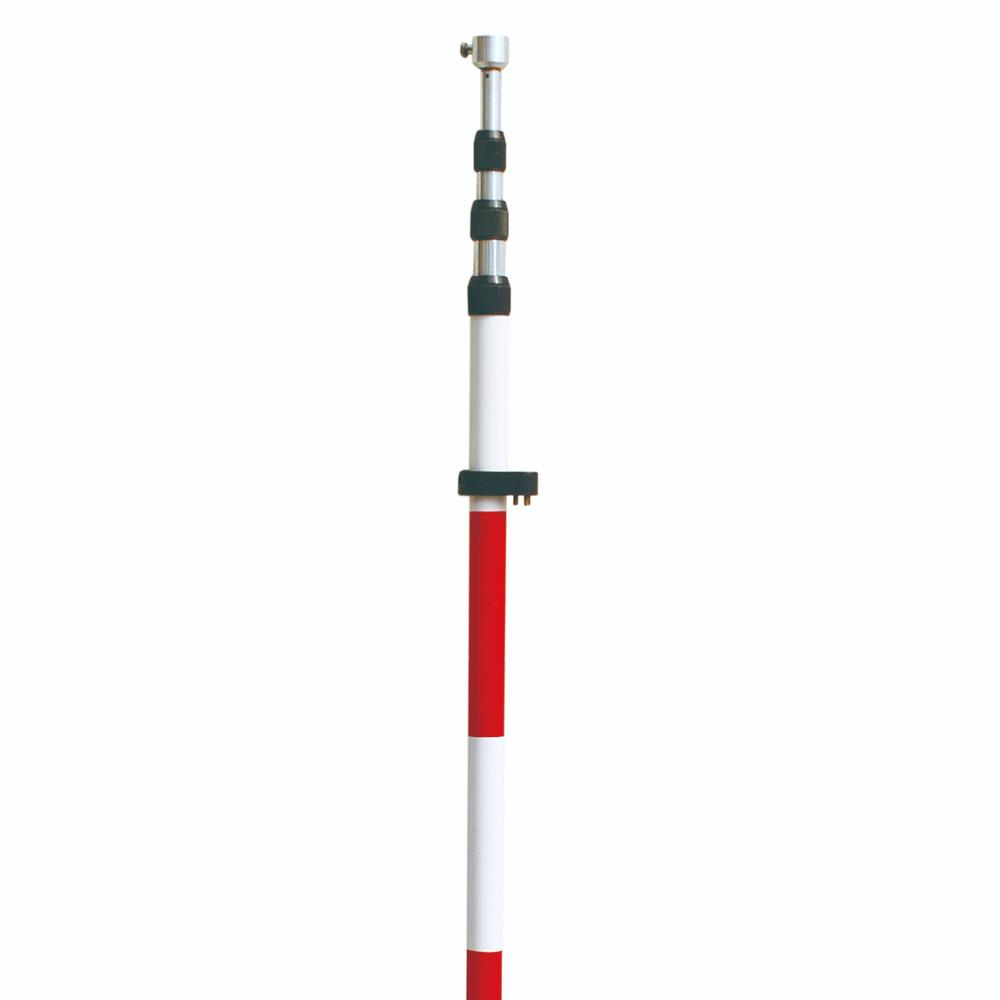
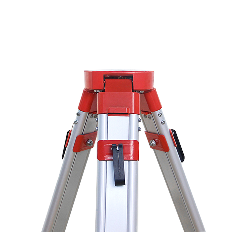
Product detail pictures:


Related Product Guide:
continue to enhance, to be certain solution top quality in line with market and buyer standard requirements. Our corporation has a excellent assurance program are actually established for High quality Rtk Gnss Gps – Surveying Instrument Hi-target IRTK5 GNSS RTK System – Haodi , The product will supply to all over the world, such as: Costa Rica, Uruguay, Tanzania, we rely on own advantages to build a mutual-benefit commerce mechanism with our cooperative partners. As a result, we have gained a global sales network reaching the Middle East, Turkey, Malaysia and Vietnamese.
This company conforms to the market requirement and joins in the market competition by its high quality product, this is an enterprise that have Chinese spirit.
Products categories
-
Factory Price For Gold Metal Detector - Tribra...
-

2022 China New Design Gps Surveying Equipment -...
-
Factory wholesale Estacin Total - New Product ...
-
Factory source Gnss Rtk V90 - Surveying Instru...
-
Wholesale Price Hi-Target V96 - Tribrach And A...
-
Factory source Ruide R2 - Professional Factory...