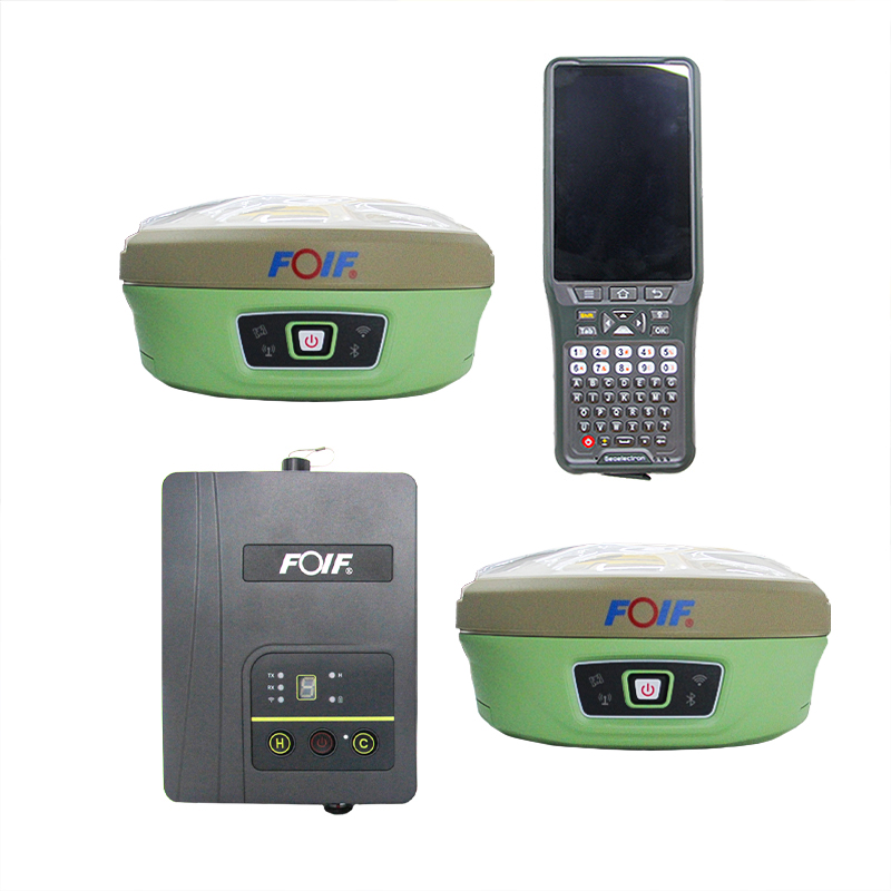
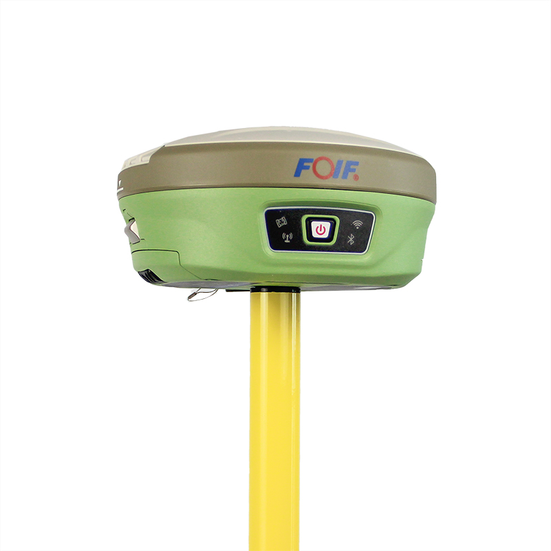
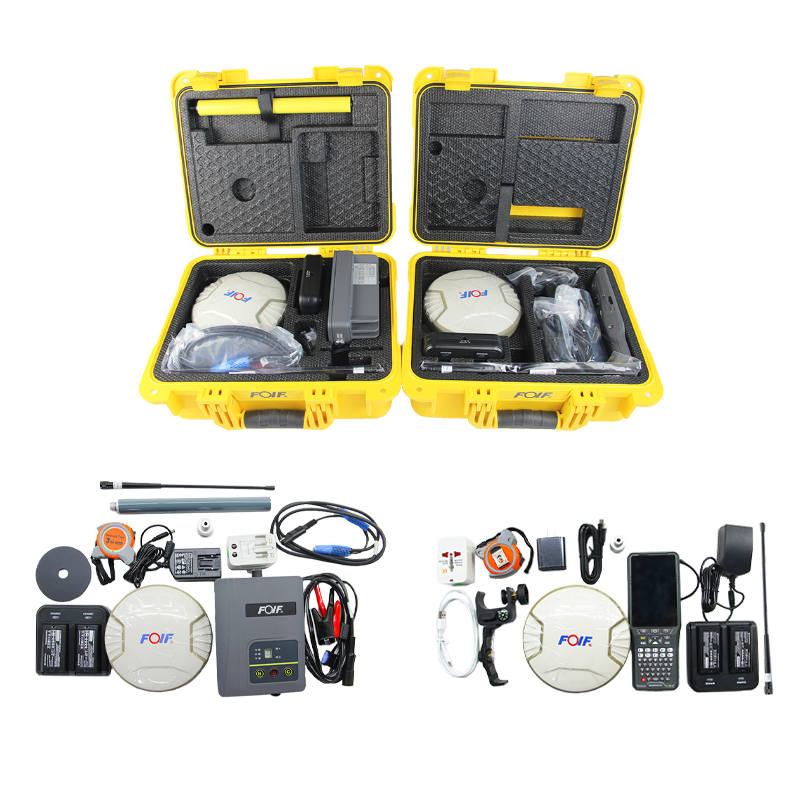
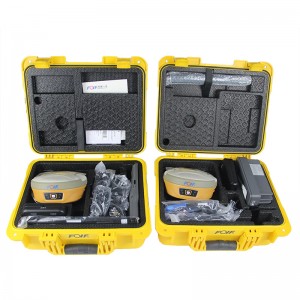
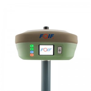
Surveying Equipment Foif A90 GNSS Gps Rtk


Top Features:
1) Smart Design
With the increasing demand for smart-design GNSS, to develop the receiver featured with miniaturization turns into our new goal until today it comes true. It is completely no doubt that small size and light weight design can greatly alleviate general field work and improve productivity a lot.
2) Brand new idea:
In terms of cellular mobile and wireless system, we tend to introduce more and more creativities into our product. Besides a set of bluetooth, wireless radio and mobile network, we bring in the WIFI function which quite broaden data communications for GNSS.
3) Excellent performance:
Embedded with high-sensitivity GNSS module , A90 can implement massive surveys:
RTK, DGPS, (SBAS) , Static, etc.
Carlson SurvCE/FieldGenius/Esurvey/SurPAD
Surpad Software Professional,intuitive and efficient
This RTK data controller Field Software is designed & developped by the most professional software R&D engineers team, which brings you a professional, intuitive and efficient measurement of the new experience. The ESurvey software integrates construction survey, power survey, GIS data collecting in one unit. This software is compatible both with Windows Mobile and Android platform, it also supports the smart phone to be used as data controller.
1. Power Survey
Line selection, cross measurement, 4-D Data Format output.
2. Road survey
Road design, Middle Side Stake Layout, Cross section survey.
3. Base Map Loading
Support vector data loading such as DXF, SHP and GCP.
4. GIS collection
Support Attribute Data Collecting by Self-Defined data dictionary and export GIS exchange format.
5. Post Processing Software GGO
Support to convert the data format into RINEX, which is compatible with AutoCAD and other Drawing & Mapping Software.
| Model | A90 | |
| GNSS | Channels | 800 |
| Signals | BDS: B1, B2, B3 | |
| GPS: L1CA, L1P. L1C, L2P, L2C, L5 | ||
| GLOASS: G1,G2, P1, P2 | ||
| GALILEO: E1BC, E5a. E5b | ||
| QZSS: L1CA. L2C. L5, L1C | ||
| SBAS: L1CA, L5; | ||
| L-Band | ||
| Accuracy | Static | H: 2.5 mm±1ppm , V: 5 mm±1ppm |
| RTK | H: 8 mm±1ppm, V:15 mm±1ppm | |
| DGNSS | <0.5m | |
| ATLAS | 8cm | |
| System | Initialization Time | 8s |
| Initialization Reliable | 99.90% | |
| Operating System | Linux | |
| Merrory | 8GB, support expanable MisroSD | |
| Wifi | 802.11 b/g/n | |
| blue tooth | V2.1+EDR/V4.1Dual,Class2 | |
| E-Bubble | support | |
| Tilt Survey | IMU Tilt Survey 60°,Fusion Positioning/400Hz refresh rate | |
| Datalink | Audio | support TTS audio broadcast |
| UHF | Tx/Rx Internal Radio, 1W/2W adjustable, radio support 410-470Mhz | |
| Protocol | support GeoTalk,SATEL,PCC-GMSK,TrimTalk,TrimMark,SOUTH,hi target | |
| Network | 4G-LTE, TE-SCDMA, CDMA(EVDO 2000), WCDMA, GSM(GPRS) | |
| Physical | Interface | 1*TNC Radio Antenna, 1*5Pin(Power & RS232),1*7Pin (USB 81 RS232) |
| Button | 1 Power Button | |
| Indication Light | 4 Indication Lights | |
| Size | Φ156mm * H 76mm | |
| Weight | 1.2kg | |
| Power supply | Battery capacity | 7.2V, 24.5Wh(standard two batteries) |
| battery Life Timer | Static Survey: 15 hours, Rover RTK survey: 12h | |
| External power source | DC 9-18V, with overvoltage protection | |
| Environment | Work Temporature | -35℃ ~ +65℃ |
| Storage Temporature | -55℃ ~ +80℃ | |
| waterproof&dustproof | IP68 | |
| Humidity | 100% anti-condensation | |
Products categories
-
Land surveying instruments with 555 channels gn...
-
Foif A80 Cheap Handheld Land Survey Equipment H...
-

FOIF A90+A70 AR Gps Rtk Base And Rover Gnss Sur...
-
Gnss Receiver Landing Gps Survey Equipment RTK ...
-

FOIF A70 AR Dual Frequency GNSS Dgps Instrument...
-
FOIF F90 GPS RTK receiver GINTEC F90 394 channe...