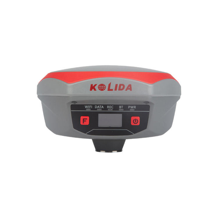
Kolida K1 Pro Cheap Receiver Gps Gnss Glonass Surveyor Equipment RTK


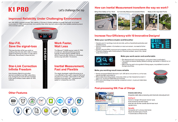
Star-Fill, Save the Signal Loss
This new function will let you to continue working a few minutes when radio or mobile signal is becoming very poor or even lose in blind area. The accuracy is down to 2cm.
Star-Link, Infinite Freedom
2cm accuracy Star-Link correction service is available! After subscribing to it, surveyors can work almost anywhere in the world without a base station or VRS network. Ideal solution for surveying and mapping, natural resource exploration in remote area.
10 Innovations to Increase Efficiency
More than 10 programs or functions were re-designed to make your work flow simpler and smoother, let you to work easier and comfortable, help you to get more reliable working result.
More Durable and Rugged
K1 PRO is fully sealed, has a IP 68 level proof. The built-in battery has 10,000 mAh capacity and can work 8 to 14 hours as RTK rover, with only one recharge.
External battery case SA6003 can add 13,600 mAh and provide extra a few working hours. (SA6003 is an optional accessory).
Work Safer and Easier
Thanks to the inertial measurement technology, K1 PRO allows user to do a tilt survey with a maximum tilt angle of 60 °. Centering is not a must, so surveyors can stay in safe position when they measure on motorway, and don’t need to step into water
Fast and accurate
Not like tilt sensor, Inertial Measurement Unit is no more affected by the earth’s magnetic field and requires no correction. It can be activated and start working within only few seconds, this fast positioning will increase measurement speed by over 30%.
The combination algorithm of IMU + GNSS can get fixed solution faster and keep measurement results more stable, accuracy is down to 2cm.
Measure where others can’t
Corner of wall? Points underneath pipe? Points occupied by car? These targets are no more accessible.
Long Range Radio Link
SDL400 built-in radio can send signal as far as 7 km in urban area, 8 km in suburban. The maximum coverage is up to 200 sq.km, suitable to have multiple rovers work simultaneously.
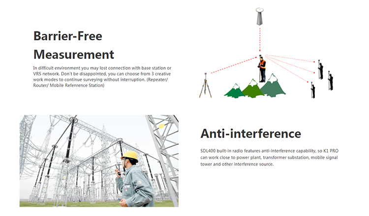
Barrier-Free Measurement
In difficult environment you may lost connection with base station or VRS network. Don’t be disappointed, you can choose from 3 creative work modes to continue surveying without interruption. (Repeater/ Router/ Mobile Refenrence Station).
Anti-interference
SDL400 built-in radio features anti-interference capability, so K1 PRO can work close to power plant, transformer substation, mobile signal tower and other interference source.
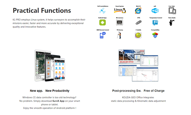
Practical Functions
K1 PRO employs Linux system, it helps surveyors to accomplish their missions easier, faster and more accurate by delivering exceptional quality and innovative features.


|
Specifications |
|
Portuguese, Spanish, Turkish and user define |
|
30 cm pole extension (with base only) |
|
7-pin to OTG cable |
|
Engineering Star (Windows) |
|
1 year warranty |
|
Field software |
|
- Field Genius (Windows) |
|
- SurvX (Android) |
|
Standard system components |
|
K1 PRO Receiver & built-in battery |
|
Charger and adapter |
|
All-direction antenna |
|
NFC chip in controller) |
|
- S50 (Android) |
|
4G |
|
Compatible with 3G GPRS/ EDGE |
|
NFC |
|
Close range (shorter than 10cm) automatic |
|
pair between receiver and controller (need |
|
typically working range 7-8km |
|
“Barrier-Free” Measurement Technology: |
|
Repeater/ Router |
|
Wifi |
|
802.11 b/g standard |
|
Hotspot: allow device to access in |
|
data link: broadcast differential data |
|
server via Wi-Fi or USB cable |
|
Voice Guide |
|
intelligent voice technology provides status |
|
WebUI |
|
Configure and monitor receiver by web |
|
indication and operation guide |
|
Chinese, English, Korean, Russian, |
|
Cellular module characteristics |
|
WCDMA/ CDMA2000/ TDD-LTE/ FDD-LTE |
|
Tape measure |
|
Optional system components |
|
External Radio (410-470 MHz, 5-35W) |
|
Battery Case SA-6003 |
|
Data collectors |
|
- H3 plus (Android), H5 (Android) |
|
- T17N (Windows mobile) |
|
- Engineering Star 5.0 (Android) |
|
1-2 year warranty extension |
|
User interface |
|
Five Indicator lights, Two buttons |
|
OLED color screen, 1 inch, 128×64 res. |
|
Linux System |
|
I/O interface |
|
5PIN LEMO external power port+RS232 |
|
7PIN external USB(OTG)+Ethernet |
|
Bluetooth 2.1+EDR standard |
|
Bluetooth 4.0 standard, support android, |
|
ios connection |
|
Operation |
|
RTK rover & base |
|
RTK network rover: VRS, FKP, MAC |
|
NTRIP, Direct IP |
|
Post-processing |
|
dust |
|
Drop: 2m pole drop on concrete |
|
Memory |
|
8GB SSD internal storage |
|
Support external USB storage (up to 32 GB) |
|
Automatic cycle storage |
|
Changeable record interval |
|
Up to 50Hz raw data collection |
|
Weight |
|
1.33 kg (with built-in battery) |
|
Environmental characteristics |
|
Operating temperature: -45° to +75°C |
|
Storage temperature: -55° to +85°C |
|
Humidity: 100% condensing |
|
IP68 waterproof, sealed against sand and |
|
Power characteristics |
|
Two Li-Ion batteries, 7.4 V, 10,000 mAh |
|
Battery life: >14h (static mode) |
|
>7h (internal UHF base mode) |
|
>8 to 14h (rover mode) |
|
External DC power: 9-28 V |
|
(KOLIDA), Hi-target, CHC, Satel |
|
1W/2W/3W switchable |
|
UHF Radio characteristics |
|
Built-in radio, 120 channels |
|
Frequency Range 410-470MHz |
|
Protocol: TrimTalk450s, TrimMark3, SOUTH |
|
RTCM 2.1, RTCM 2.3, RTCM 3.0, RTCM 3.1, |
|
- IRNSS: L5 – SBAS: L1C/A, L5 |
|
Accuracy: down to 2cm |
|
Output data formats: |
|
NMEA 0183, PJK plane coordinates, Binary |
|
GNSS characteristics |
|
336 GNSS channels (672 channels optional) |
|
- GPS: L1C/A, L1C, L2C, L2E, L5 |
|
- BeiDou: B1, B2, B3 |
|
Initialization: |
|
- GLONASS: L1C/A, L1P, L2C/A, L2P, L3 |
|
(QZSS, WASS, MSAS, GAGAN, EGNOS) |
|
- Global Correction Service (MSS L-Band) |
|
Supported data formats: |
|
time <10s, reliability >99.99% |
|
RTCM 3.2, CMR CMR+ |
|
code, Trimble GSOF |
|
L-band Correction Service |
|
Star-fill: 5 minutes, down to 2 cm accuracy |
|
Star-Link: down to 2 cm accuracy (need |
|
subscription) |
|
- Galileo: E1, E5A, E5B, E5AltBOC, E6 |
|
Inertial Measurement |
|
Tilt Angle: up to 60 degrees |
|
Positioning Accuracy |
|
Code differential GNSS positioning |
|
Horizontal: ±0.25m+1ppm |
|
Vertical: ±0.50m+1ppm |
|
SBAS: 0.5m (H) 0.85m (V) |
|
Static and Fast Static |
|
Horizontal: ±2.5mm+0.5ppm |
|
Vertical: ±5mm+0.5ppm |
|
Network RTK (VRS, FKP, MAC) |
|
Horizontal: ±8mm+0.5ppm |
|
Vertical: ±15mm+0.5ppm |
|
RTK initialization time |
|
2~8s |
|
Physical characteristics |
|
Size |
|
16.3 x 16.3 x 9.6 cm |
Products categories
-

SOUTH Insight V3 Gps Rtk 1698 Channels Gnss Rtk...
-
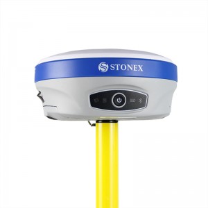
GNSS RTK System Base And Rover Station Stonex S...
-
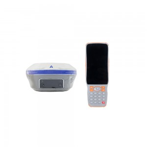
Hi Target Irtk20 Base And Rover Good Price Gnss...
-
CHC X16 Pro High Accuracy Gnss Receiver Cheap P...
-
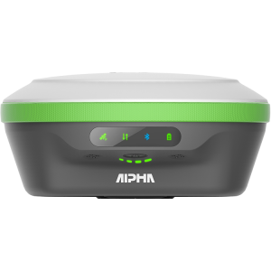
Alpha T Series Gnss Base And Rover Handheld Gps...
-

GNSS RTK System Base And Rover Station Stonex S...