Product Detail
Product Tags
| Satellite Tracking Ability |
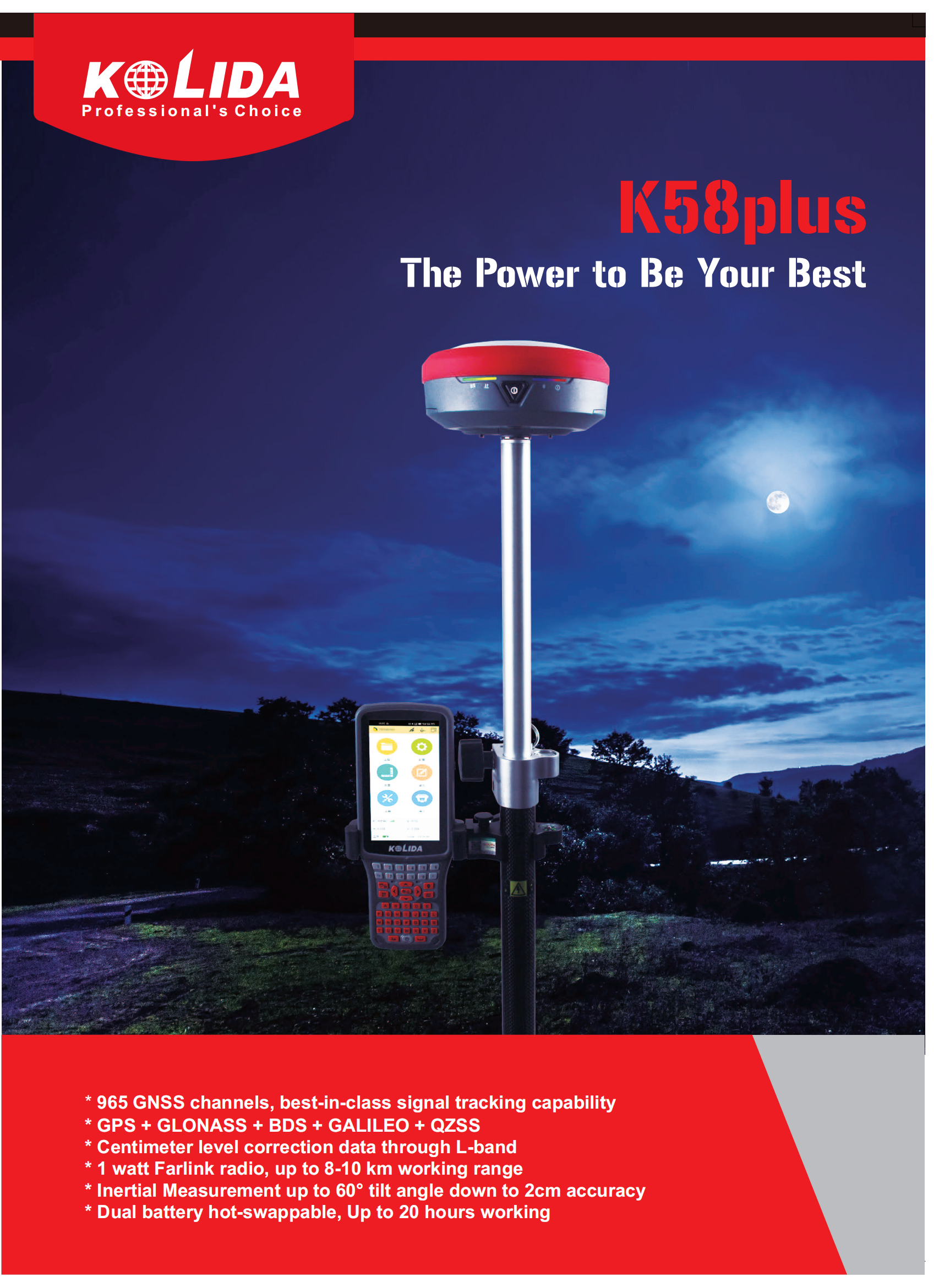
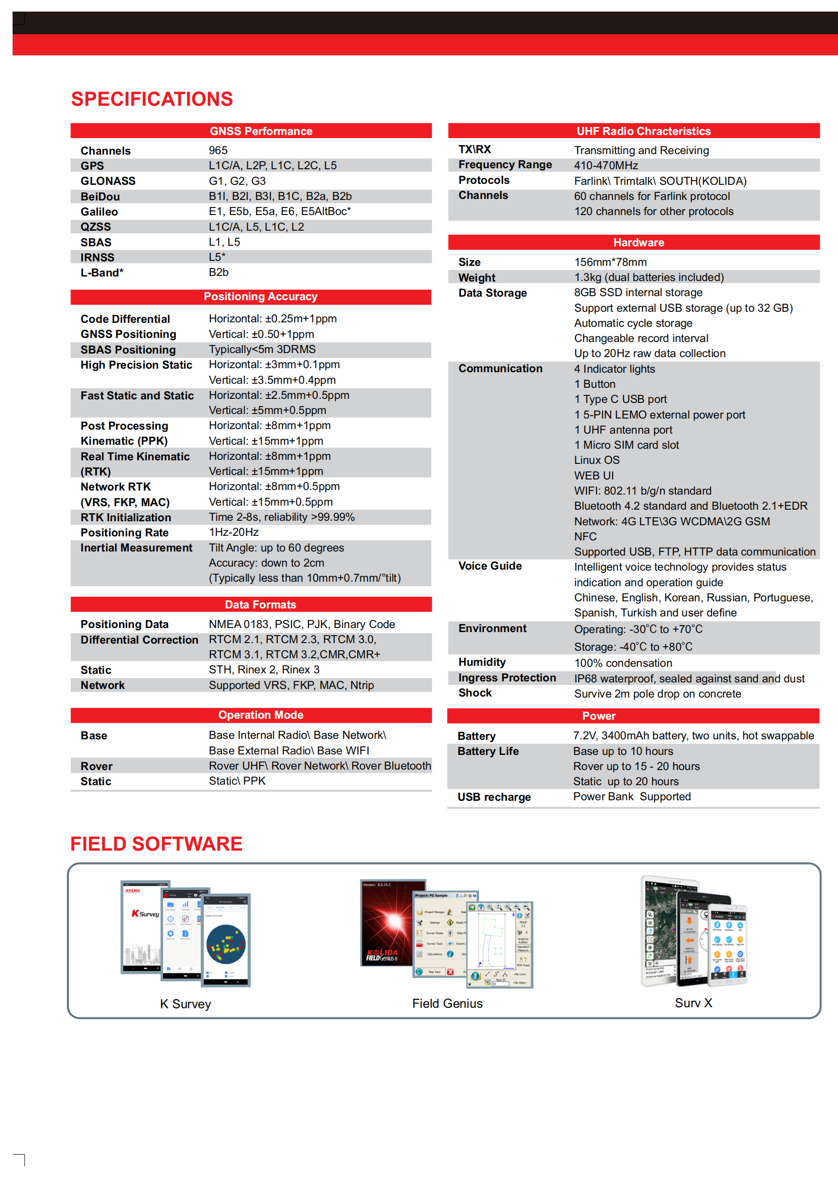
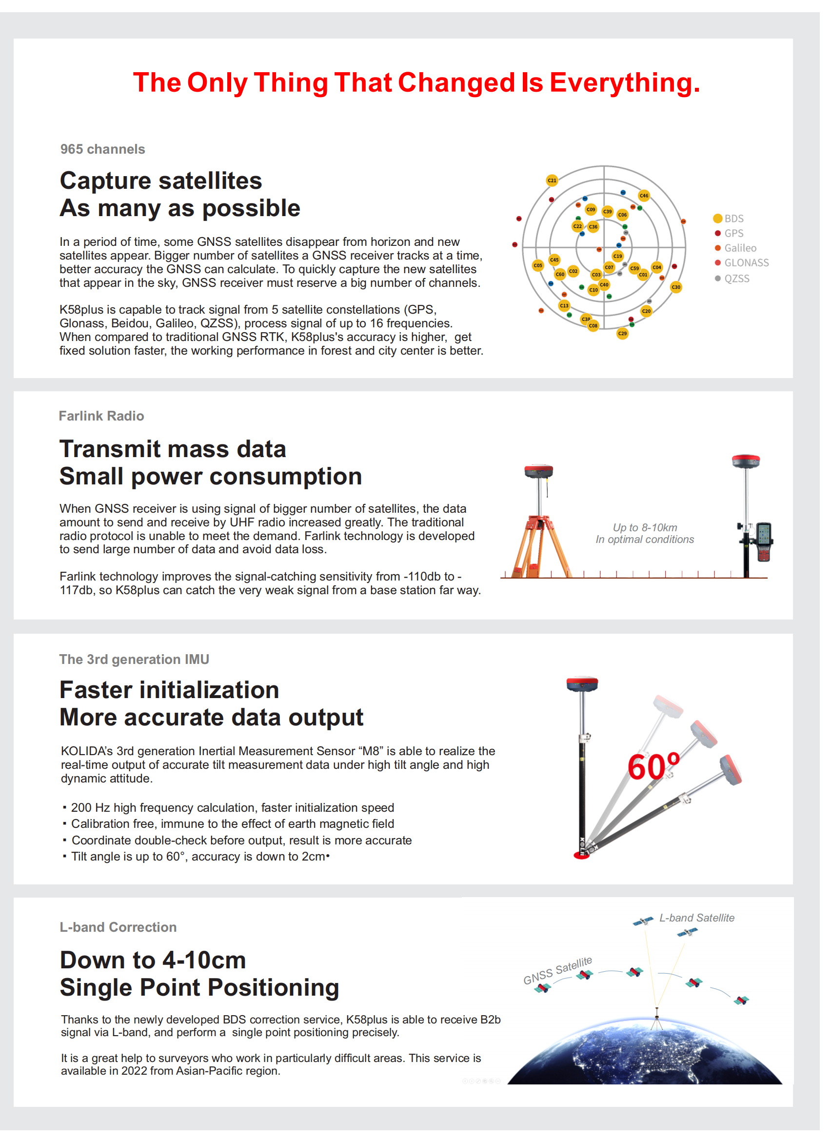
| Channels:965 channels |
Constellation |
L-BandB2b, available to work in Asia-pacific region |
| GPS, GLONASS, BEIDOU, GALILEO, QZSS, SBAS |
| Positioning Output Rate1-20 HZ |
Initialization Time2-8 s |
|
| Positioning Precision |
|
|
| UHF RTKHorizontal ±8mm +1 ppm |
Network RTKHorizontal ±8mm +0.5 ppm |
|
| Vertical ±15mm +1 ppm |
Vertical ±15mm +0.5 ppm |
| Static and Fast-Static |
RTK Initial time |
|
| Horizontal ±2.5mm +0.5 ppm |
|
| Vertical ±5mm +0.5 ppm |
2-8s |
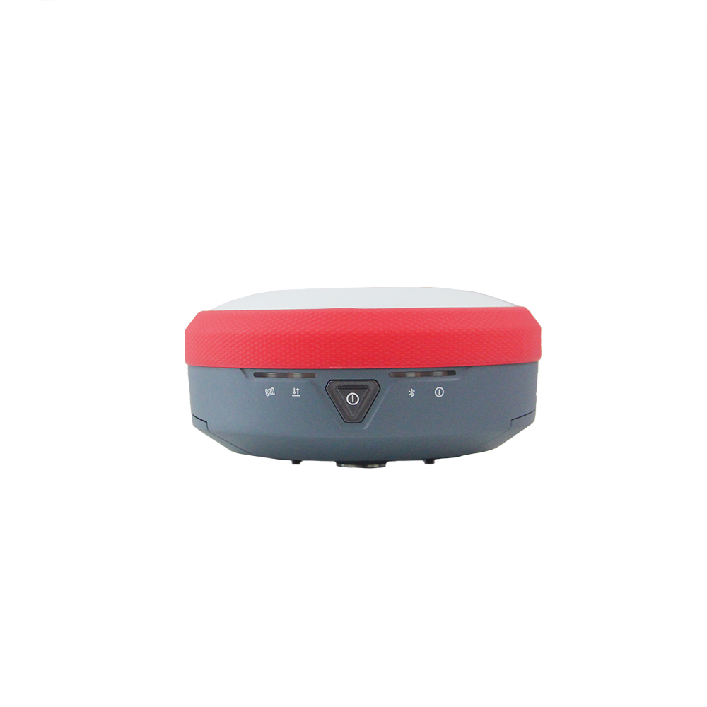
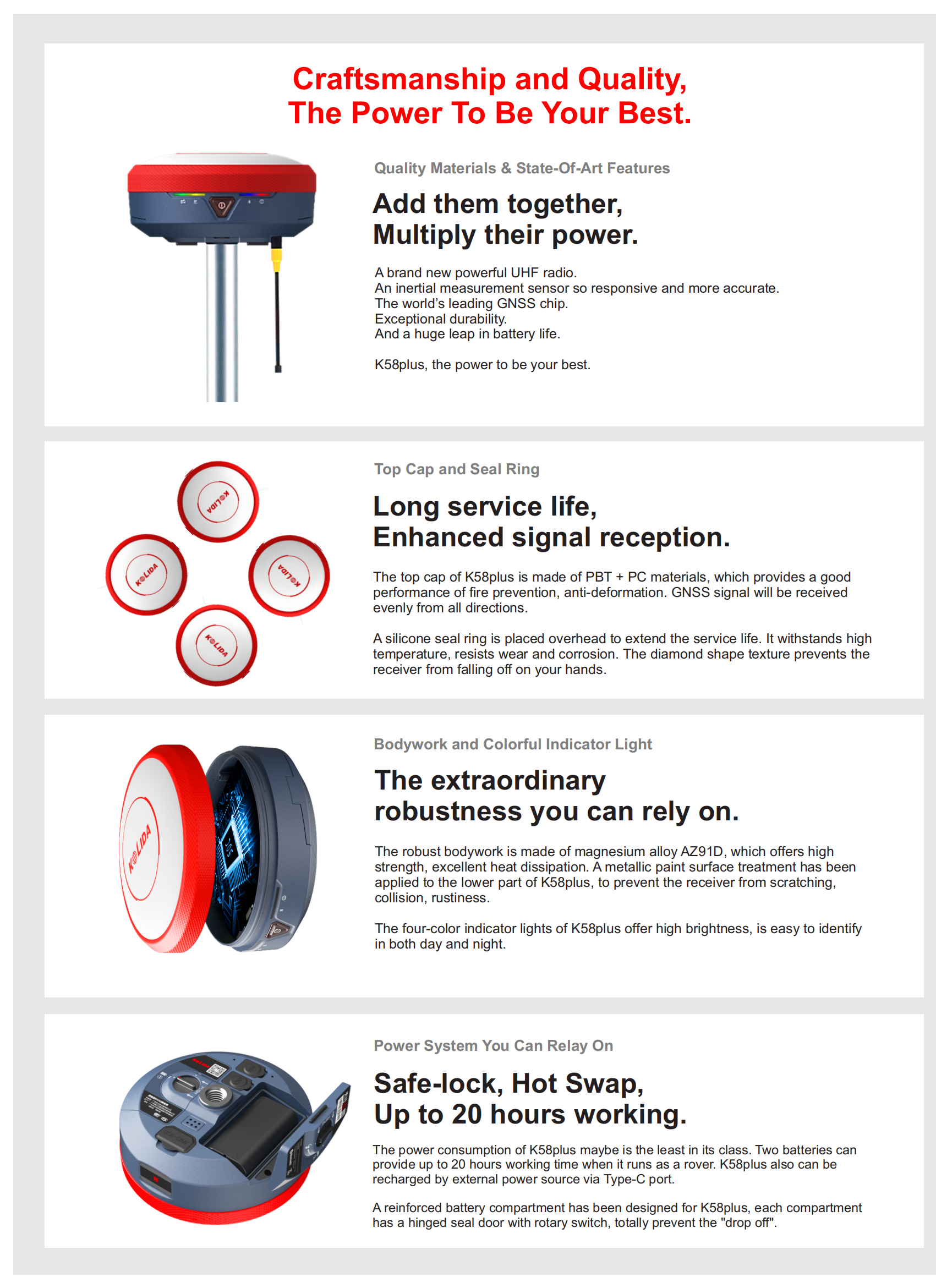
| User Interaction |
|
|
| Operation SystemLinux |
Screen DisplayNo |
wifiYes |
| Voice Guideyes, 8 language |
Data Storage8 GB internal, 32GB external |
Web UIYes |
| Keypad1 physical buttons |
|
|
| Working Capability |
|
|
| RadioBuilt-in transmitting and receiving |
Tilt Survey |
Electronic BubbleYes |
| Inertial Measurement |
| Endurance |
OTG (Field Download) |
|
| up to 20 hours (static mode), up to 15-20 hours (rover mode), up to 10 hours (base mode) |
yes |
|

Previous:
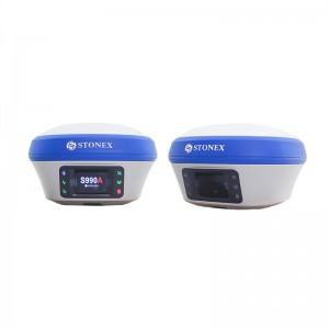
Unistrong G990II Base And Rover Gnss Receiver Gps Survey Equipment
Next:
Stonex S5II/S990A Land Gps Surveying Equipment Gnss Rover And Base Station RTK