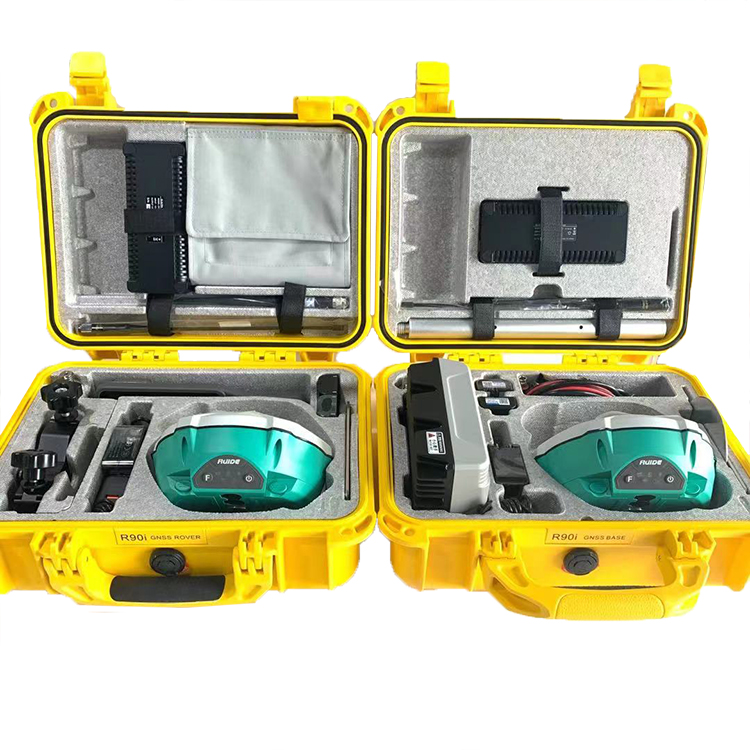
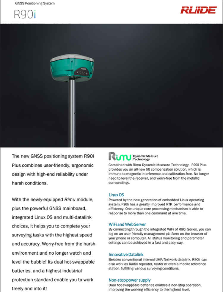
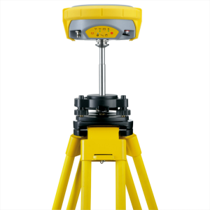
RUIDE R90i Surveying Instrument 692channels IMU Tilt RTK GPS GNSS


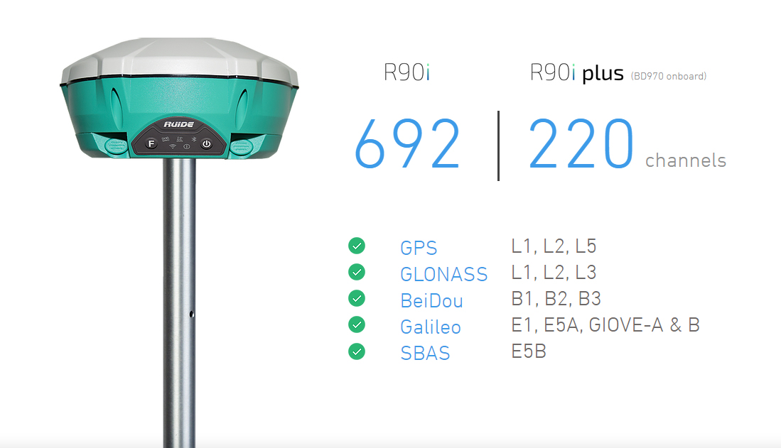

| Pacific Peak BD970 board, has 220 channels |
| Global Positioning System L1C/A, L1C, L2C, L2E, L5 |
| Glonus L1C/A, L1P, L2C/A, L2P, L3 |
| Galileo Giove-A, Jove-B, E1, E5A, E5B |
| Bedou B1, B2 |
| QZS, Vass, Mas, Egnos, Gagan, Bath. |
| Free Glonus, Galileo, and Bedu have no time limit and no code to activate them. |
| Phase fuzzy resolution algorithm, fixed solution time < 10 seconds. |
| Measurement rate 1Hz-50Hz. |
| RTK accuracy: 8 mm + 1ppm (level), 15 mm + 1ppm (elevation). |
| The RIMU tilt sensor has an operating range of up to 60° and an accuracy of<2 cm (up to 60°), <5 cm (up to 60°). |
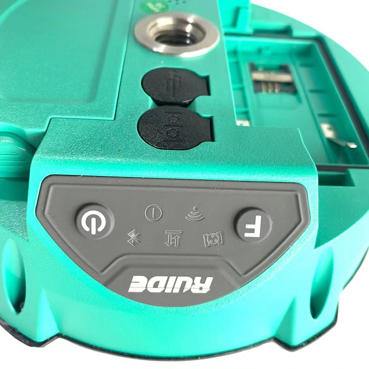
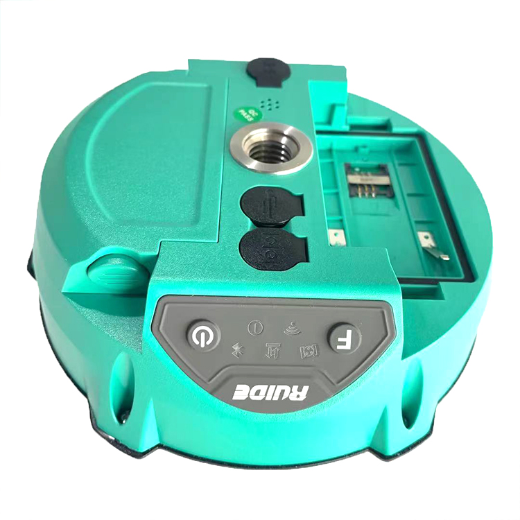
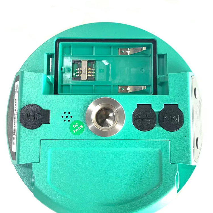
| Wireless wireless networking technology with a built-in web server. |
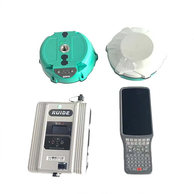
| Able to use the receiver as a rover, but also as a base, without any modifications to the hardware. |
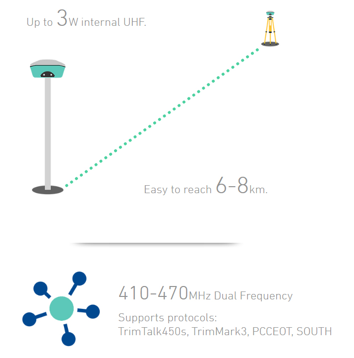
| Multiple communication options: internal UHF modems, but also internal GSM/GPRS. |
| Two rechargeable lithium-ion batteries are enough for a full day’s work. |
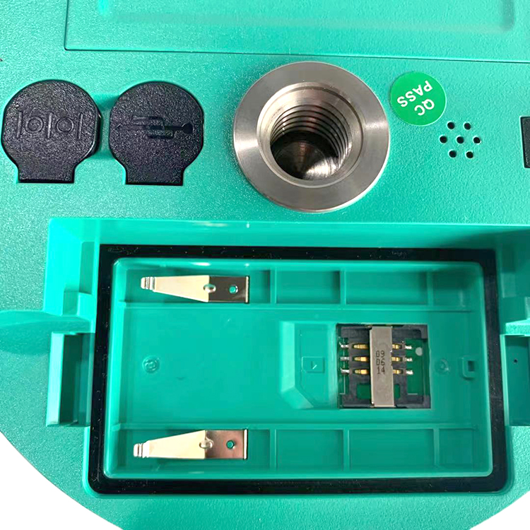
| 8GB of internal storage for collecting static measurement data. |
| Compatibility with VRS, FKP, and MAC networks such as HEPOS. |
| Weighs only 1330GR (with batteries). |
| Fully waterproof and dustproof device (IP67).It endured a drop from a height of 2 meters. |
| Blue tooth wireless communication with external recording. |
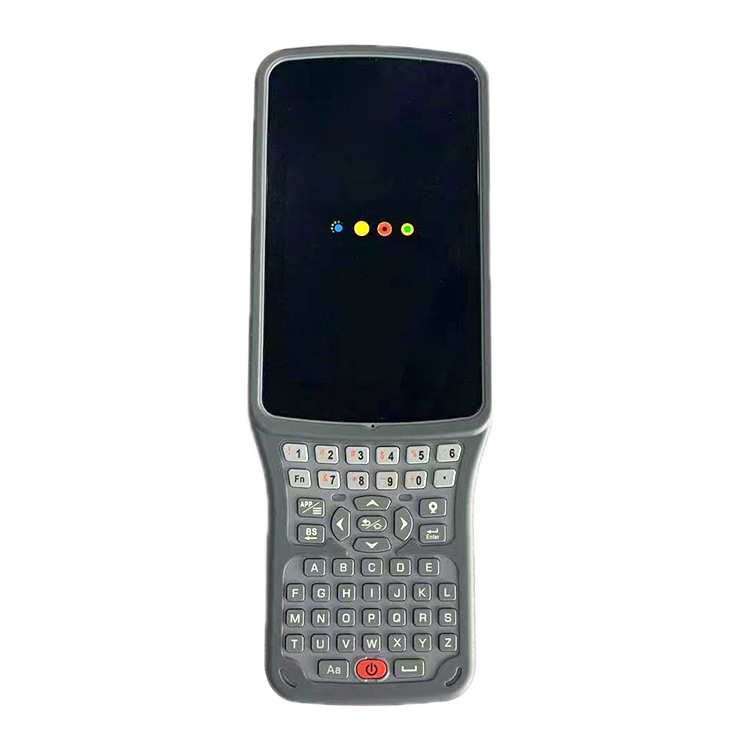
| The built-in LED indicator constantly informs the user of the status of Blue tooth, modem, satellite, WiFi and power. |
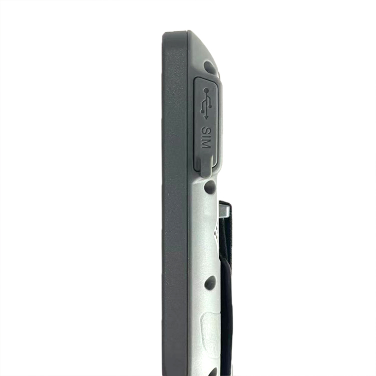
| Communication port: 1X RS232, 1XUSB, 1X Blue tooth. |
Products categories
-
GEOMAX ZG20 Rtk Surveying Instrument Base and R...
-

CHCNAV IBASE/T1 Gps Land Survey Gnss Base Stati...
-
Geomax Zenith 15 Pro Geodetic Equipment Used Su...
-
Gnss Receiver Landing Gps Survey Equipment RTK ...
-
CHC B5 Survey Instrument Base Station Gnss Rtk ...
-

Beidou CM3 GNSS Rtk Gps High Precision Gnss GPS...