Products
-
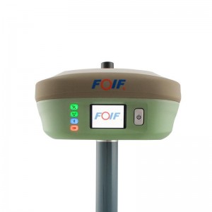
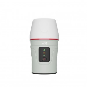
Sino T30 Survey Equipment High Accuracy Gnss Dual-Frequency GPS Receiver RTK
Performance Channels 1198 Satellites tracking - GPS: L1 C/A, L2C, L2P, L5 - BeiDou: B1, B2, B3 - BeiDou Global Signal: B1C, B2a - GLONASS: L1 C/A, L1P, L2 C/A, L2P - Galileo: E1, E5a, E5b, E6, AltBOC - QZSS, IRNSS - L- Band - SBAS: WAAS, EGNOS, MSAS, GAGAN Network RTK 8 mm + 0.5 ppm Horizontal 15 mm + 0.5 ppm Vertical Post Processing Kinematic(PPK) 5 mm + 1 ppm Horizontal 5 mm + 1 ppm Vertical PPP 10cm Horizontal and 20cm Vertical Standalone 1.5 m 3D RMS ... -

Sino T300 Gps Rover And Base Station Cheap Price Gnss Receiver Rtk
Performance Signal tracking Channels: 965 channels Satellite tracking: GPS,BDS, GLONASS, Galileo,QZSS,Navic and SBAS RTK Horizontal accuracy: 8 mm + 1 ppm RTK Vertical accuracy: 15 mm + 1 ppm Post Processing Horizontal accuracy: 2.5 mm + 1 ppm Post Processing Vertical accuracy: 5 mm + 1 ppm Initialization time: less than 10 s Physical Size(W x H): 15.8 cm 7.5 cm Weight (incl. supplied two batteries): 0.95 kg (2.1 lb) Operating temperature: -40 °C to + 65 °C (40 °F to ... -
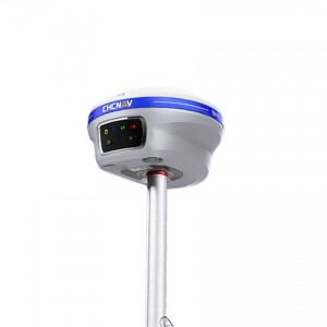
Sino Mars Pro Laser Gnss Gps Receiver Gps Rover And Base Station Construction Survey Equipment Rtk
Specifications Performance Channels 1668 GPS L1C/A, L1C, L2P, L2C, L5 BDS B1I, B2I, B3I,B1C,B2a,B2b GLONASS G1, G2, G3 Galileo E1, E5a, E5b, E6c, E5 AltBOC QZSS L1C/A, L2C, L5, L1C IRNSS L5 SBAS L1C/A Signal Re-acquisition ≤1s RTK Initialization Time <10s (Baseline≤10km) Network RTK Horizontal 8 mm + 0.5 ppm Vertical 15 mm + 0.5 ppm Post Processing Kinematic(PPK) Horizontal 5 mm + 1 ppm Vertical 5 mm + 1 ppm Static and Fast Static Horizontal 2.5 mm + 0.5... -
Sino A100 Rover Survey Equipment Gps Gnss Surveying Instrument Rtk
Performance Channels 965 Signal Received - GPS: L1C/A, L1C, L2P, L2C, L5 - BDS: B1I, B2I, B3I, B1C, B2a, B2b - GLONASS: G1, G2, G3 - Galileo: E1, E5a, E5b, E6c, E5 AltBOC - QZSS: L1C/A, L2C, L5,L1C - IRNSS: L5 Single Baseline RTK Horizontal: 8 mm+1 ppm Vertical: 15 mm+ 1 ppm DGPS <0.4 m RMS SBAS Horizontal: 0.5m RMS Vertical: 0.8m RMS Physical Size (L x W x H) Φ132 x 72 (mm) Weight 750g Input Voltage 9 – 36 VDC Power consumption 2.6 W Maximu... -
Sino Venus Laser Dual Frequency Land Measuring Gps Gnss Surveying Instrument RTK
Performance Channels 1590 GPS L1C/A, L1C, L2P, L2C, L5 BDS B1I, B2I, B3I,B1C,B2a,B2b GLONASS G1, G2, G3 Galileo E1, E5a, E5b, E6c, E5 AltBOC QZSS L1C/A, L2C, L5, L1C IRNSS L5 SBAS L1C/A Signal Recapture ≤1s RTK Initialization Time <10s (Baseline≤10km) Static and Fast Static Horizontal 2.5 mm + 0.5 RMS Vertical 5 mm + 0.5 RMS Signal Baseline RTK Horizontal 8mm + 1ppm RMS Vertical 15mm + 1ppm RMS DGPS <0.4m RMS SBAS Horizontal 0.5m RMS Vertical 0.8m RMS... -
Chc X15/i89 Dual Frequency Gnss Cheap Handheld Survey Gps Surveying Instrument Rtk
TECHNICAL PARAMETER project content index Satellite tracking Satellite system GPS+BDS+Glonass+Galileo+QZSS Support Beidou three generations, support Five star 21 frequency point Satellite tracking BDS: B1I,B2I,B3I,B1C,B2a,B2b* GPS: L1C/A,L1C,L2C,L2P,L5 GLONASS: G1,G2,G3 Galileo: E1,E5a,E5b,E6* QZSS: L1C/A,L1C,L2C,L5 IRNSS: L5* SBAS: L1C/A* Channel 1408 Initialization reliability 99.99% No network continued test support Signal acquisition sensitivity Typical... -
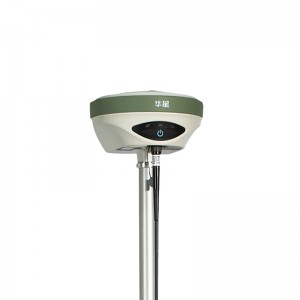
Hi Target A12 cheapest Gnss receiver Gnss measurement equipment intelligent inertial Gnss receiver Rtk
System configuration Operating system: Linux Startup time: 3S Data storage: Built-in 8GB memory, support for up to 32GSD card expansion GNSS configuration System kernel: Using the international first-class PCC multi-star multi-system kernel Number of channels: 220 BDS:B1、B2 GPS:L1C/A、L2E、L2C、L5 GLONASS: L1C/A, L1P, L2C/A (only GLONASSM), and L2P GALILEO: upgrade reservation Output format: ASCⅡ:NMEA-0183 and binary: TrimbleGSOF Differential support: sCMRx, CMR,... -
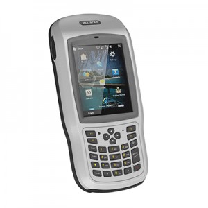
Surveying Accessories Thunder Industrial Handheld
Surveying Accessories Thunder Industrial Handheld Model No HH1-1M HH1-2A Overview CPU 806MHz 1.3GHz RAM 512M 2G ROM 4GB 16G Operating system Windows 6.X Android 5.1 64bit Camera 5 MP 8 MP Keyboard 27 numeric + programmable keys Display 3.7″ sunlight readable with integrated touch screen 480*640 IPS Dimension 200mm x 96mm x 32mm Weight 515g with battery GNSS Perfarmance GNSS GPS L1+BD L1/GPL L1+GLONASS L1 Channels 72 channels NMEA-0183 yes A... -
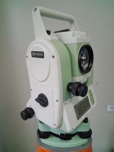
Precis TS3-3 Reflectorless High-quality Dual-axis Compensator Total Station
SPECIFICATIONS Angle Measurement Measurement Method Absoulte Encoding Minimum Readout 1″/5″/10″ (0.3mgon/1.5mgon/3mgon) adjustable Accuracy 2″ Dlstance Measurement (with Reflector) Single Prism 3000m (9842ft) under good condition Three Prisms 6000m (19,685ft) under good condition Reflective Sheet 800m (2,642 ft.) Accuracy 2mm + 2ppm Measuring Time (Fine/ Tracking) 0.8s/0.3s Dlstance Measurement ... -
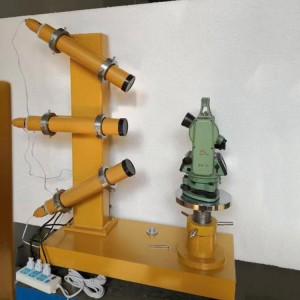
High Quality Survey Instrument Collimator Laser Totoal Station Calibration Stand
1 Magnification: 5.7-7X 2 Aperture: 55mm 3 Resolution: 3” 4 Dimension:168x110x55(mm) 5Total weight:200kg 1.Number of collimator tube: 4pcs 2.Focus: 565mm 3.Aperture: 55mm 4.Focus:550 5.Accuracy(Reticle’s division value): 20″ 6.Shortest target: 2m 7.Medium and far target: ∞ 8.Micro adjusting range: ≤ 20″ 9.Lifting range of the lifting platform: 300mm 10.Max. Loading weight on support column: 40kgs 11.Optical plummet inside the support column 12.Magnification: 5.7~7X ... -
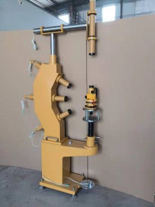
Optical Collimator For Laser Totoal Station Calibration Stand Survey Instrument
1 Magnification: 5.7-7X 2 Aperture: 55mm 3 Resolution: 3′ 4 Dimension:168x110x55(mm) 5Total weight:200kg 1.Number of collimator tube: 4pcs 2.Focus: 565mm 3.Aperture: 55mm 4.Focus:550 5.Accuracy(Reticle’s division value): 20″ 6.Shortest target: 2m 7.Medium and far target: ∞ 8.Micro adjusting range: ≤ 20″ 9.Lifting range of the lifting platform: 300mm 10.Max. Loading weight on support column: 40kgs 11.Optical plummet inside the support column 12.Magnification... -